A mile ago at the beginning of the hike I remember thinking how easy the start of this hike is.
You cross a babbling creek or raging river depending on what season it is. The river bed is filled with gorgeous granite rocks of every size and color and you hope, fingers crossed, no rattle snakes today. Than you cross the creek and enter the forest and the trail kind of meanders a bit and it might get a little buggy here depending on the season.
This is Momyer Trail that visits Alger Creek and eventually thirteen miles and 5,200 feet later the top of San Gorgonio. This is the route to the top of San G with the most eventual altitude gain. It is also one of the longest routes, some people say it can be done in eight hours. The San Bernardino Peak Trail cuts off at about 6,500 feet and veers to the east. From what I have read online the hike to the top of this mountain is about seven miles with 5,000 foot altitude gain. This is well known to be one of the steepest trails around. After 8,000 feet the trail goes pretty much straight up for a thousand feet; so I have heard, I have never actually made it that far. It was hard enough to hike this peak on a February morning, I can not imagine people back packing this in June!
After we left the brisk creek water crossing behind (Most of my friends carrying their little dogs across) the scrub oak forest we had just entered was shady at last as the oak trees made a canopy blocking out the hot morning sun light.
 |
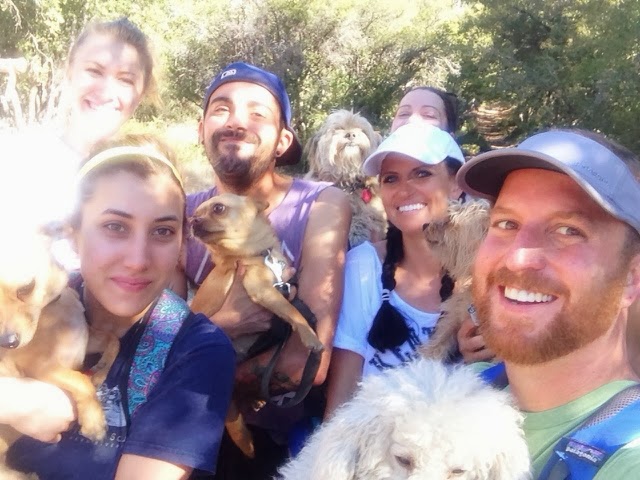
| This dog is smiling because he doesn’t have a tick on him yet. |

Up to this point the meandering woodsy trail had left the creek beds and granite strewn area of the forest behind and we had been slowly working our way up a dusty trail side in full sun light.
There are about 6 switch backs you sludge up in full sun, no shade to be found until a few corners up when you enter a deep shrub oak forest again.
The shade of this scrub oak forest was a welcome relief on this hot day.
This hot February day.
It had felt about as eighty degrees as we made our way up into the forest on our journey up the San Bernardino Peak Trail today.
I had convinced eight friends and four rat dogs to join us on this murderous hike up the mountain today.
I had not done this trail in at least a month and forgot how steep it was. A friend who lived in the nearby hamlet of Forest Falls was our actual trail guide for the day and I believe she had said something about how this trail branched off and ended up high above the Big Falls water falls and meadows and alpine glens and blah blah blah, I was under the impression we were not doing that hard of a hike and had convinced a lot more friends than anticipated to come out with me and do a little hike in the forest.

Eight miles, 2,500 feet in altitude gain and two ticks later I’m a little surprised they are still speaking to me.
Extremely hard hike aside we did a awesome job of making the San Bernardino Peak Trail our bitch today and I am so proud of how well my friends did on this hike which was quite honestly possibly the hardest hike I will ever drag them on.
Like how she had seen a bear and cubs on this very trail a month ago.
 |
| Fir Tree |

She told me her boyfriend had told her the best thing to do when encountering a bear was to wave your shirt at it.
Really? This seems like something a boy would say in order to see boobs. I explained to every one contrary to popular belief, bears are not actually scared of boobs.
If you see a bear in the forest do not flash it! This will not help!
How about a real nature lesson…
Details for the San Bernardino Peak Hike
Sunscreen, snacks, 113 liters of water depending on how many miles you want to do.
First aid kit, wide brimmed hat
Local Lowdown:
Stop for lunch afterwards at Casa Maya in Mentone
Helgas Sugar Shack or good old A & W Hamburgers on Mentone Blvd.
There is also a fruit stand on the North side of the road on Mentone Blvd that has amazing candy, produce and dried fruit.